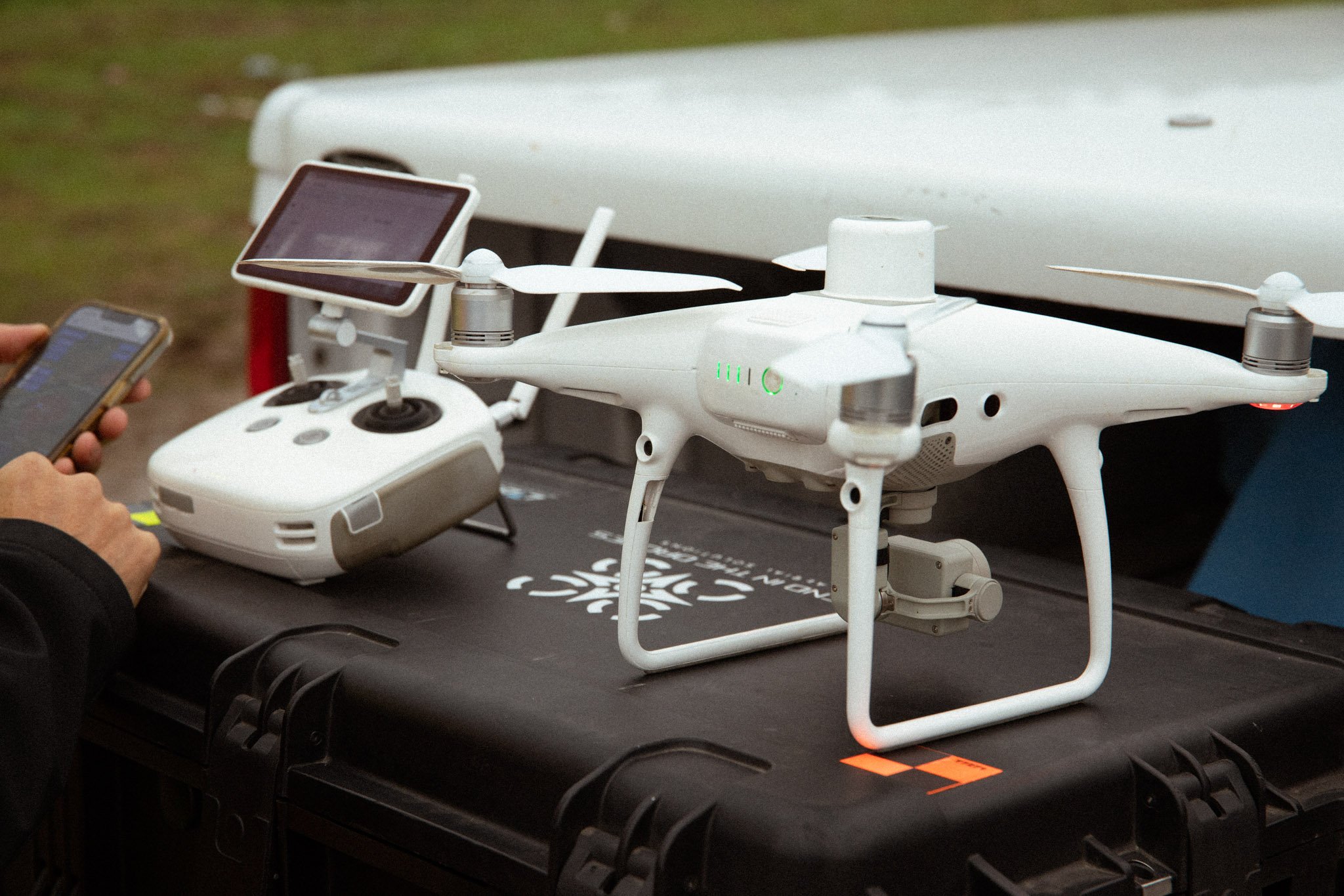
Our Drone Services
We provide industrial-grade aerial surveying and inspection services that save time, reduce risk, and deliver data-driven results. From volume calculations to thermal inspections, we help you see more — with precision you can trust.
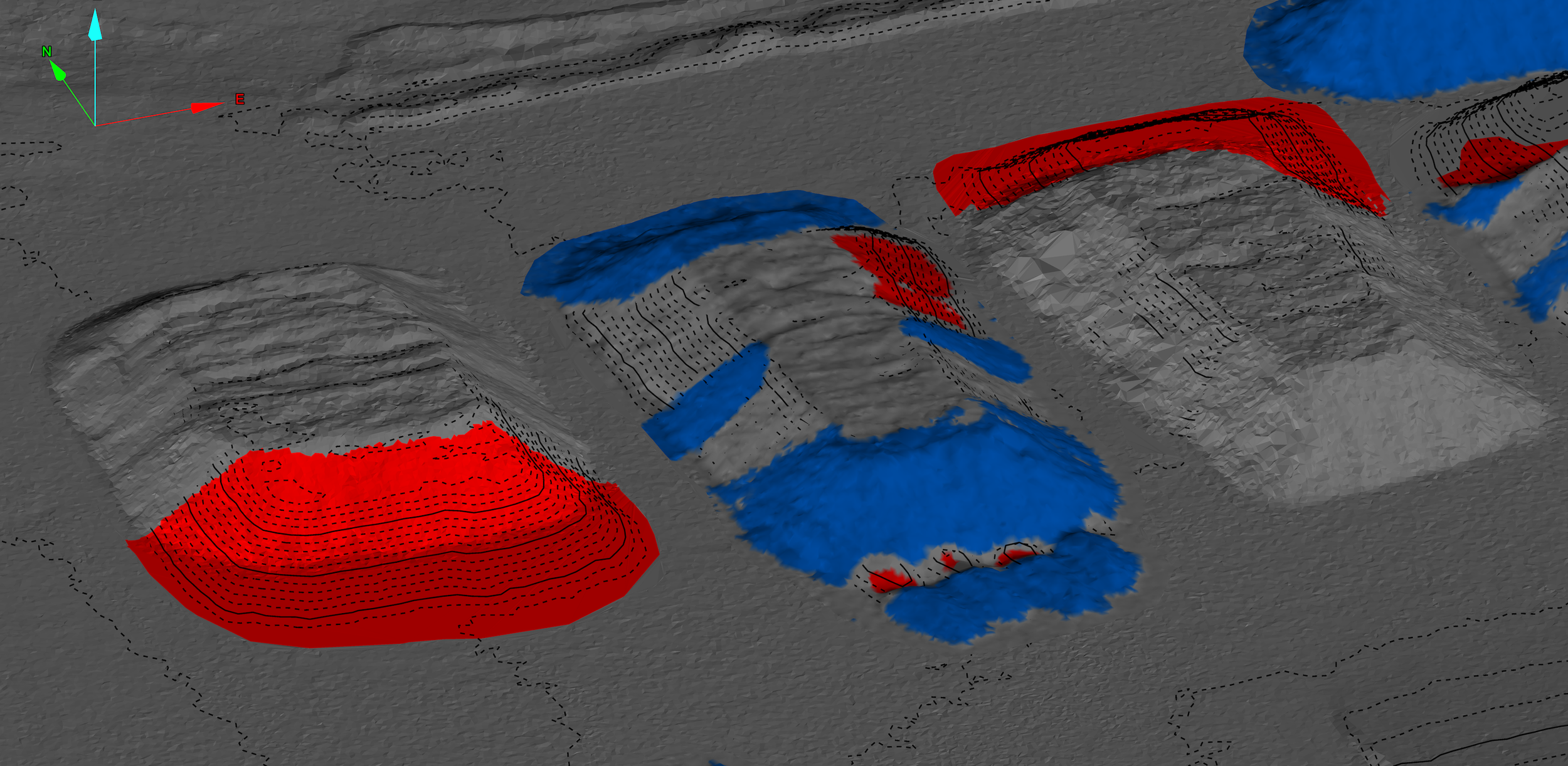
Volume & Stockpile Calculations
-
This is where accuracy pays off. Our drone-based volume calculations and stockpile surveys help you know exactly how much material is sitting at your depot — and how much it’s worth. We calculate pile volumes for sand, gravel, soil, and other bulk materials with centimeter-level precision.
-
No shutdowns needed — we can survey your site while operations continue, minimizing downtime. Our quick turnaround times mean you get accurate data fast, whether for inventory management, billing, or compliance documentation.
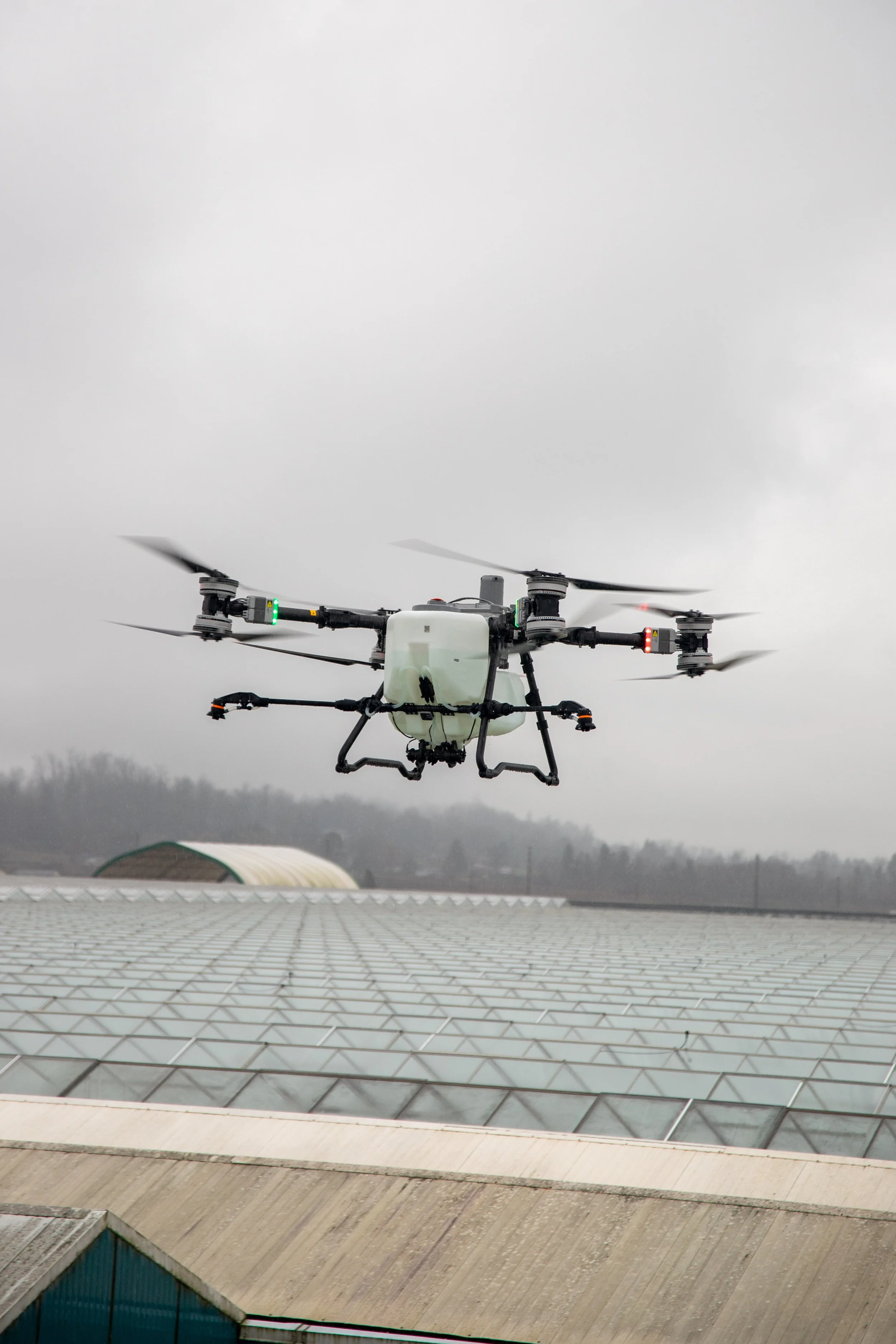
Agriculture & Precision Drone Spraying
-
Partnering with SKYAG Solutions, our agricultural drone spraying services provide fast, precise, and efficient crop protection for greenhouses and large-scale operations. Using advanced spray drones, we deliver targeted application across your site — reducing waste, minimizing disruption, and improving overall coverage.
-
Drone spraying allows us to access tight or sensitive areas without the need for heavy equipment, helping reduce soil compaction and avoid damage to crops or infrastructure. With carefully planned flight paths and calibrated spray systems, every application is controlled, consistent, and tailored to your operation.
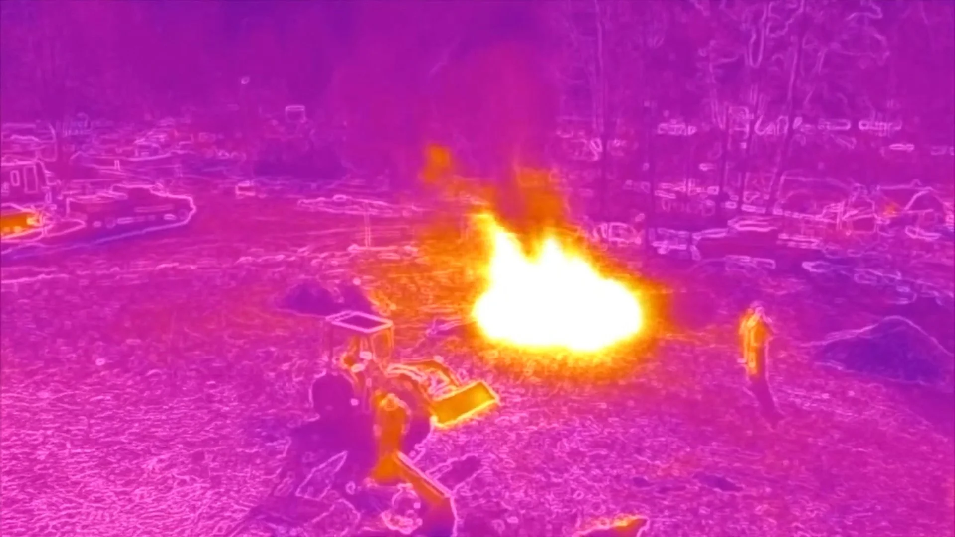
Thermal Imaging & Heat Detection
-
Our thermal drone inspections identify issues before they become costly. Detect heat loss, overheating circuits, or underperforming solar panels across large sites in minutes. Perfect for energy audits, solar arrays, electrical grids, and even locating livestock in remote terrain.
-
With high-resolution thermal imaging and advanced data analysis, we help you find problems fast — reducing downtime, improving safety, and saving energy.
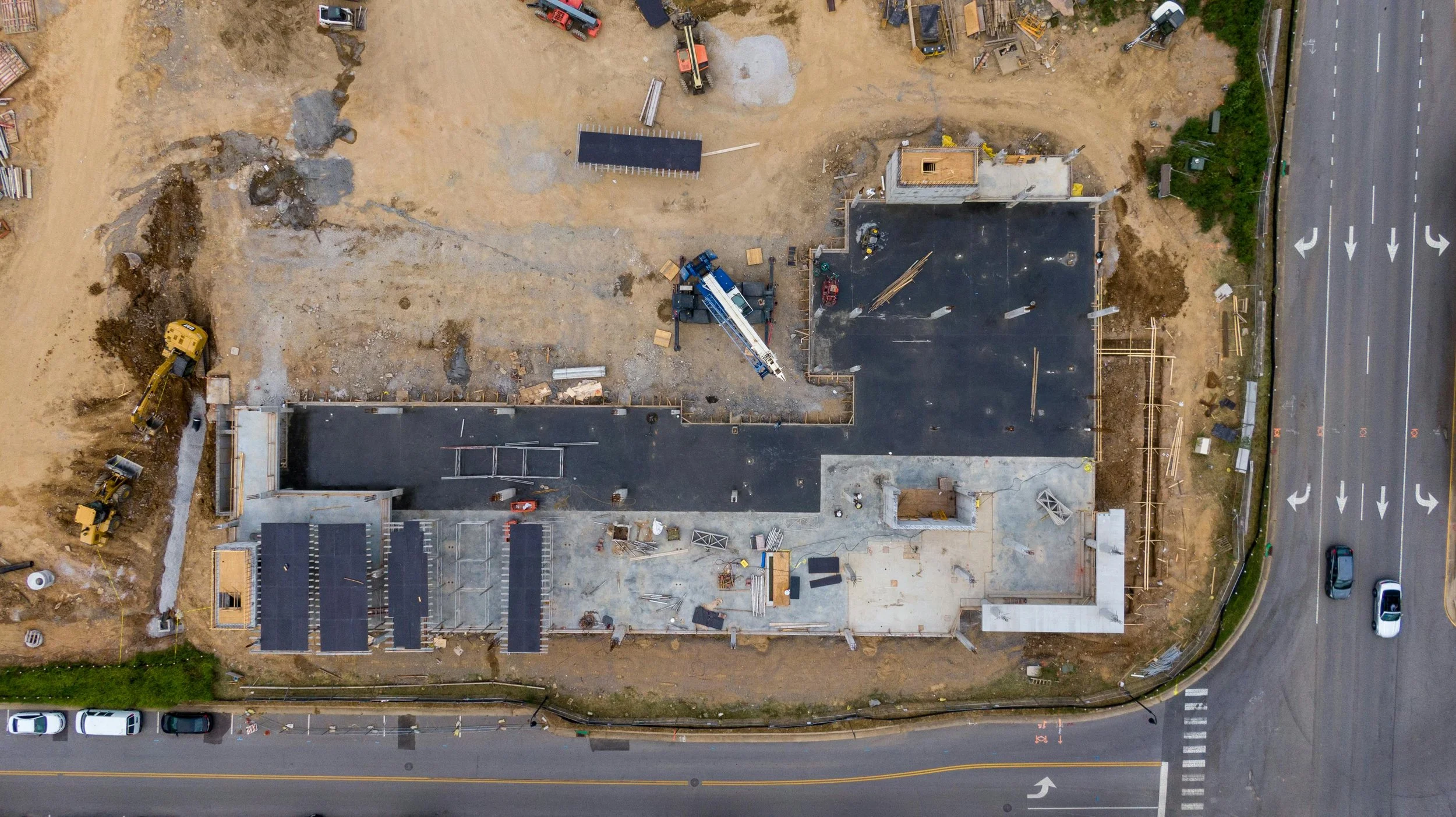
Construction & Site Inspections
-
Stay informed on every stage of your project. Our drone construction inspections provide orthomosaic images, elevation maps, and 3D visualizations that keep all stakeholders aligned. Verify progress, confirm safety compliance, and support insurance claims with timestamped, high-resolution imagery.
-
From small development sites to 100-acre industrial builds, we deliver full-site overviews in under 40 minutes — letting you track progress, detect delays, and maintain transparency with clients and regulators.
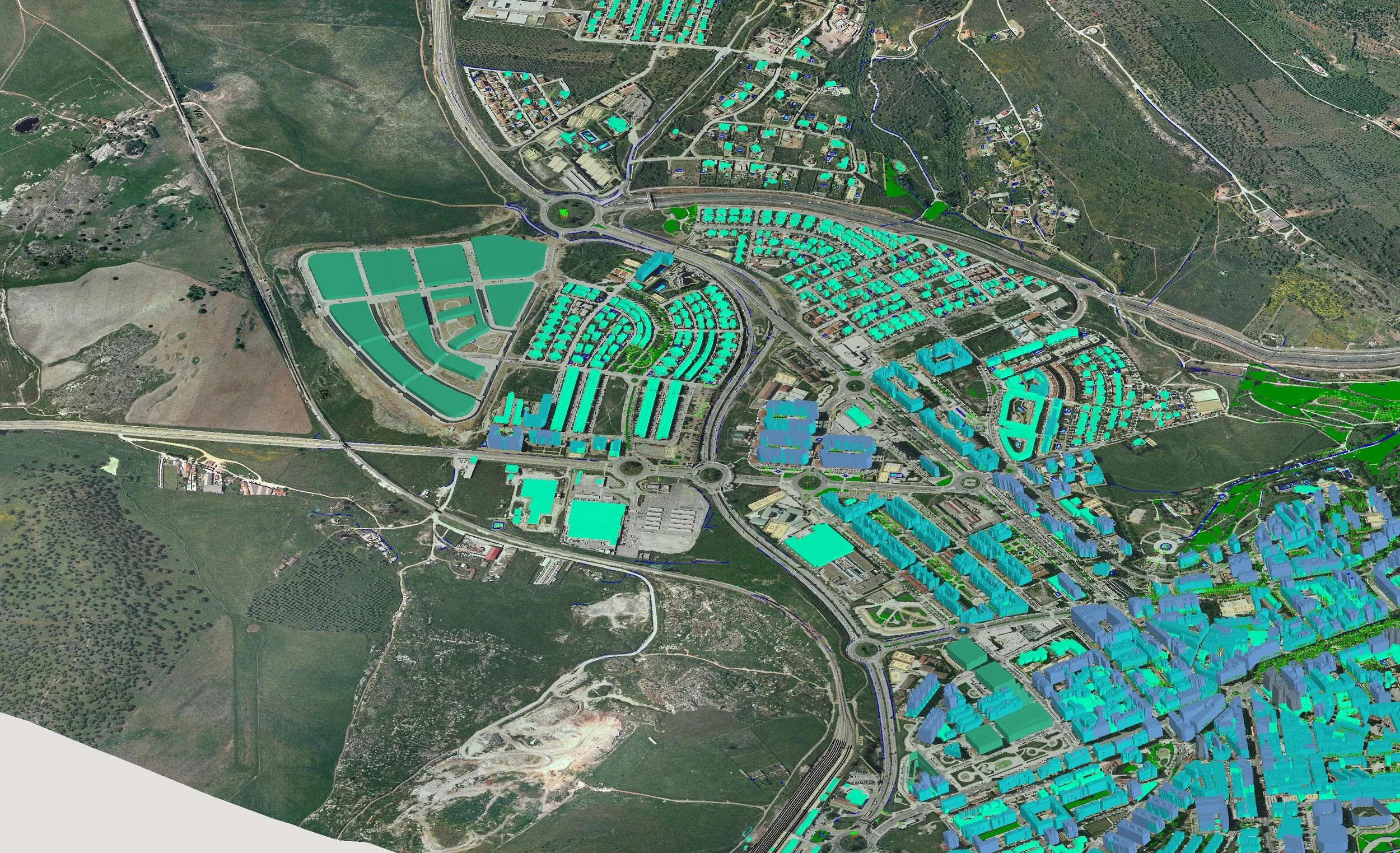
Precision Mapping & GIS Integration
-
Using RTK and NTRIP positioning technology, our mapping services achieve centimeter-level accuracy for survey-grade results. We can permanently install Ground Control Points (GCPs) on your site to streamline future projects and ensure consistent geospatial alignment.
-
We work directly with your GIS or engineering teams to deliver imagery and data in multiple formats — including GeoTIFF, JPEG, Rasta, and KML — ensuring seamless integration with your existing software systems.
Quote Your Next Project
Whether you’re tracking stockpile volumes, verifying construction progress, or inspecting solar arrays, we’ll deliver the accurate data you need — safely and efficiently. Let’s talk about your site and how we can help.
Our Clients